For VFR flying over certain regions in Brazil, it is mandatory to fly through VFR corridors witch have both lateral and vertical restrictions, as in the following example:
We can’t use the VFR map on the Charts application to fly VFR without the corridors information.
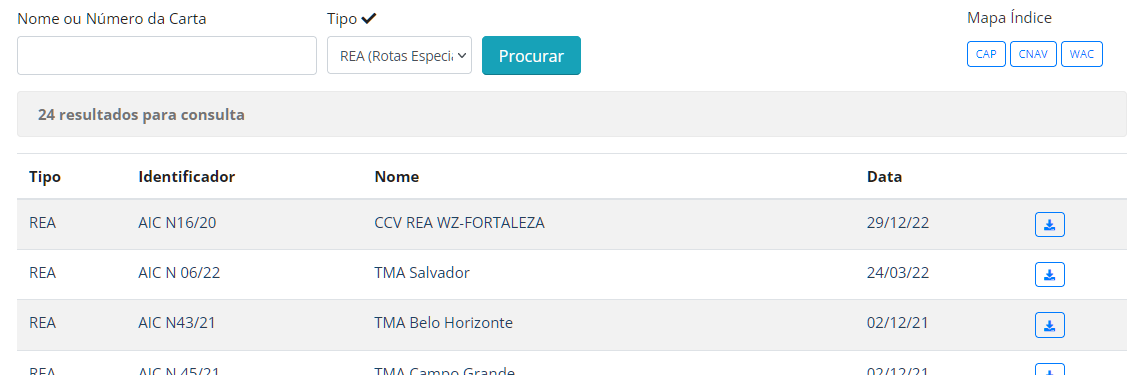
There are currently 24 VFR corridor charts across the main cities of the country, they are called REA, and can be found here: https://aisweb.decea.mil.br/?i=cartas&p=visuais
Select REA on the search box and click on “Procurar” (Search):
REA | AIC N16/20 | CCV REA WZ-FORTALEZA | 29/12/22
REA | AIC N 06/22 | TMA Salvador | 24/03/22
REA | AIC N43/21 | TMA Belo Horizonte | 02/12/21
REA | AIC N 45/21 | TMA Campo Grande | 02/12/21
REA | AIC N42/21 | CTR PORTO SEGURO | 02/12/21
REA | AIC N 36/21 | TMA Cuiabá | 14/09/21
REA | AIC N 20/21 | TMA São Paulo 2 | 20/05/21
REA | AIC N 20/21 | TMA São Paulo e Vale do Paraíba | 20/05/21
REA | AIC N 20/21 | TMA RIO DE JANEIRO | 20/05/21
REA | AIC N 18/21 | TMA Natal | 20/05/21
REA | AIC N 13/21 | TMA Recife | 22/04/21
REA | AIC N 15/21 | TMA Manaus | 22/04/21
REA | AIC 48/20 | CTR SANTARÉM | 31/12/20
REA | AIC N33/20 | TMA Florianópolis | 10/09/20
REA | AIC N 13/20 | CTR RIBEIRÃO PRETO | 23/04/20
REA | AIC N 51/18 | TMA Macapá | 04/10/18
REA | AIC N 52/18 | TMA Vitória | 04/10/18
REA | AIC N30/18 | TMA Curitiba | 22/03/18
REA | AIC N 10/17 | TMA Brasília | 20/07/17
REA | AIC N 02/17 | TMA Porto Alegre | 05/01/17
REA | AIC N23/16 | TMA Anápolis | 08/12/16
REA | AIC 09/15 | TMA Londrina | 19/06/15
REA | AIC 21/12 | TMA São Luis | 01/12/12
REA | AIC N12/10 | TMA Amazônica | 03/06/10
My request is to have them added to the Navigraph Charts app, so we can fly VFR in Brazil safely and accurately. Thank you!
HELLO, i am a real pilot in Brazil, and a simulator intusiast too, i own my way to create a waypoints off the REA, but is a lot of them, my request is the same, please, inser the REA at NAVIGRAPH.
THANKS
I’ve just tested the brand‑new VFR Charts (Brazil), and they represent a great improvement for VFR navigation across Brazilian territory. The addition of the WAC layer in this update significantly enhances situational awareness—thank you to the entire Navigraph team for delivering this feature.
I would like to point out, however, that the REA (Rotas Especiais de Aeronaves — Aircraft Special Routes) layers are currently missing. These charts are normally displayed on top of the WAC layer so pilots can correctly plan their navigation using the designated corridors for each specific REA.
The link below lists all available REAs along with their respective charts. They are also accessible through AISWEB, Brazil’s official aeronautical information service.
Below just an example of a REA and how it helps set the proper route via the corridors
First of all, I would like to sincerely thank you for bringing the official Brazilian VFR charts to Navigraph. This is a fantastic addition and a very important milestone for the Brazilian flight simulation community.
As a Brazilian content creator and Navigraph partner, I can already see how much this feature will improve the VFR flying experience in Brazil. Having the official DECEA VFR charts integrated into Navigraph makes visual navigation much more realistic, practical, and enjoyable.
I would also like to thank you once again for taking the time to listen to my previous feedback regarding the South American community. Your willingness to listen to your users is something I truly appreciate.
If I may, I would like to make one additional suggestion for a future update.
Would it be possible to consider adding the Brazilian Visual Corridor Charts (REA and REH)?
Although there are relatively few of these charts, they are widely used during real-world VFR operations in Brazil, especially around our busiest controlled airspace. They are an important part of VFR flight training and day-to-day operations, and their inclusion would make the Brazilian VFR experience inside Navigraph even more complete and authentic.
The official DECEA chart portal already provides access to these charts. On the page below, there is a filter where you can select REA (Special Aircraft Routes) and REH (Special Helicopter Routes):
I believe adding these Visual Corridor Charts would be greatly appreciated not only by Brazilian users but also by anyone interested in flying VFR in Brazil using real-world procedures.
Once again, congratulations on the excellent work. It is truly exciting to see Navigraph continuously expanding its worldwide coverage and investing in regions that have historically had limited VFR resources.
Thank you very much for your time, and please keep up the outstanding work!
Best regards,
Reinaldo
Cupim Aeroclube Virtual
Only one issue per thread so that others can easily see what has been reported.
I would love to see VFR routes charts availiable on the VFR charts, most major airports have them it would be awesome to have them on the cockpit specially with the new avionics plugin! They look like this
Also it would be cool if the waypoints could somehow be added to the database, I used to have a custom waypoint set for those on XP back in the day which I made myself, it would be really nice and handy to see them on MFS, is there a way to add a pack of custom waypoints like from a notepad or something that I’m unaware of? I would make them myself again
I’ve tested the new VFR Charts Brazil feature, and in this thread I’m sharing my impressions—particularly regarding the absence of the REA chart layer. My suggestion is that we use this thread below as the central place to discuss any further improvements or suggestions related to VFR Charts Brazil.
Admitting you guys are considering adding this, even though the main traffic volume is for aeroplanes, REH (Special Helicopter Route) charts could also be considered, in addition to REA (Special Aircraft Route) charts.
Cheers and thank you very much for the work so far,
We would greatly appreciate it if you could include the Visual Corridors (REA) on Brazilian charts. This feature significantly enhances flight safety by allowing pilots to accurately determine their position while flying published REA visual procedures.
Could you please consider adding this feature for the Brazilian community? Brazil represents a large and passionate part of the flight simulation community, and this would be a truly valuable improvement for all of us after so many years of using Navigraph.
Thank you for your continued support and for considering our request.
Warm regards from Brazil!