I previously saw people asking for the Quiet Bridge Visual and I get that they are not in the database. But the two procedures I mentioned in the title is supposed to be in the FMS except for that they are for some selected airlines like UAL AAL afaik.
Just want to make sure, what I need to provide is something like: SUSAP KSFOK2FI28R I 010CEPINK2PC0E I IF IGWQK2 10380120 PI J 030000180018000 0 NS 132061310
Hi,
I’m sorry, but that’s not the standard ARINC424 format. I guess it is the X-Plane format. We can’t use this, sorry, but thanks for sharing at least for X-Plane users
Hi! I coded the procedure in the ARINC 424 format. And updated the FMS BV 28R since I found a newer chart of it. However I did not have the program to verify the procedure this time so please let me know if there’s anything wrong with it.
Hi! Just wanna make sure both procedures will be a part of the next cycle (2511) since I don’t find the RNAV Visual 1R and the FMS BV 28R is the first version I provided.
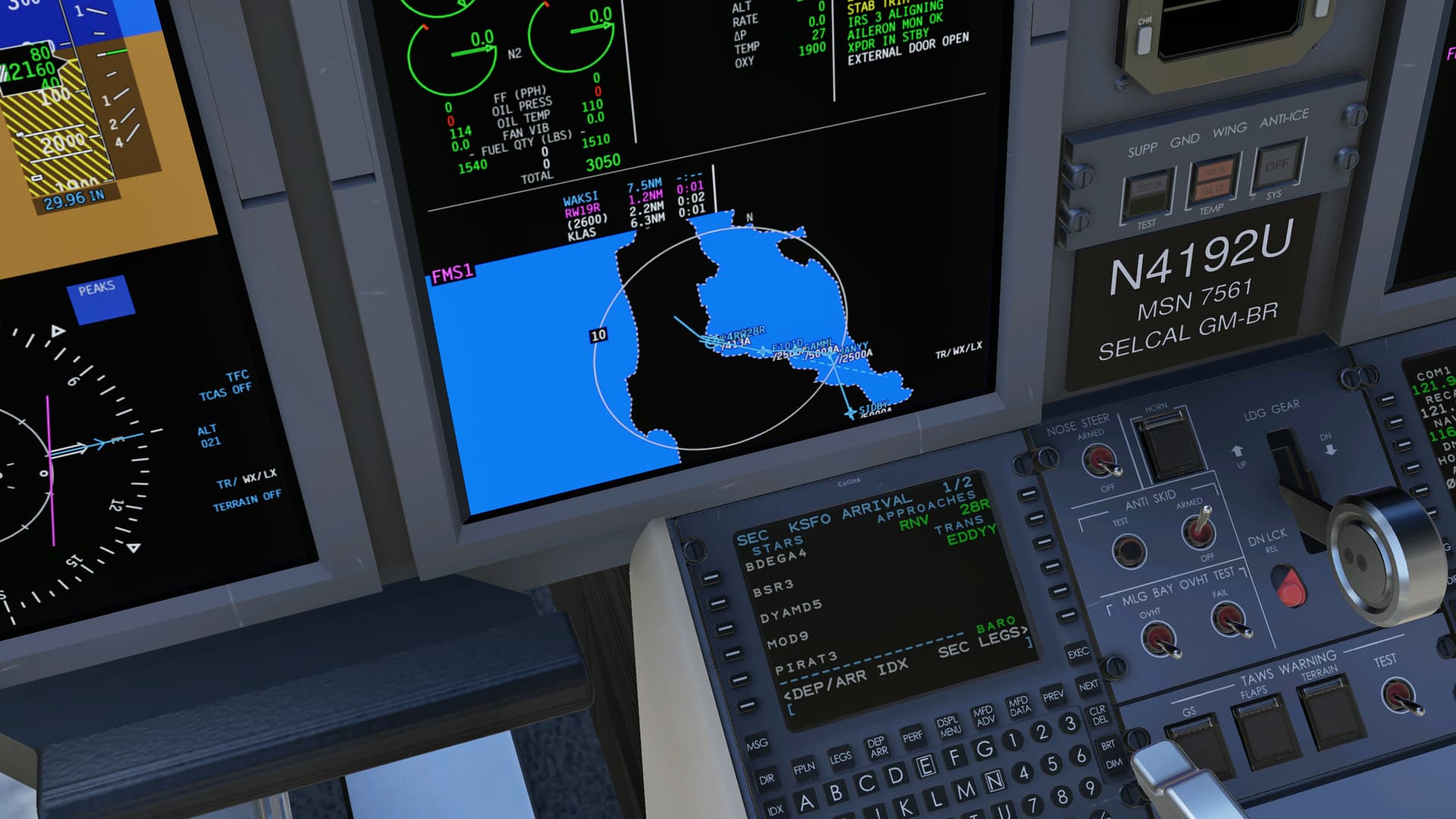
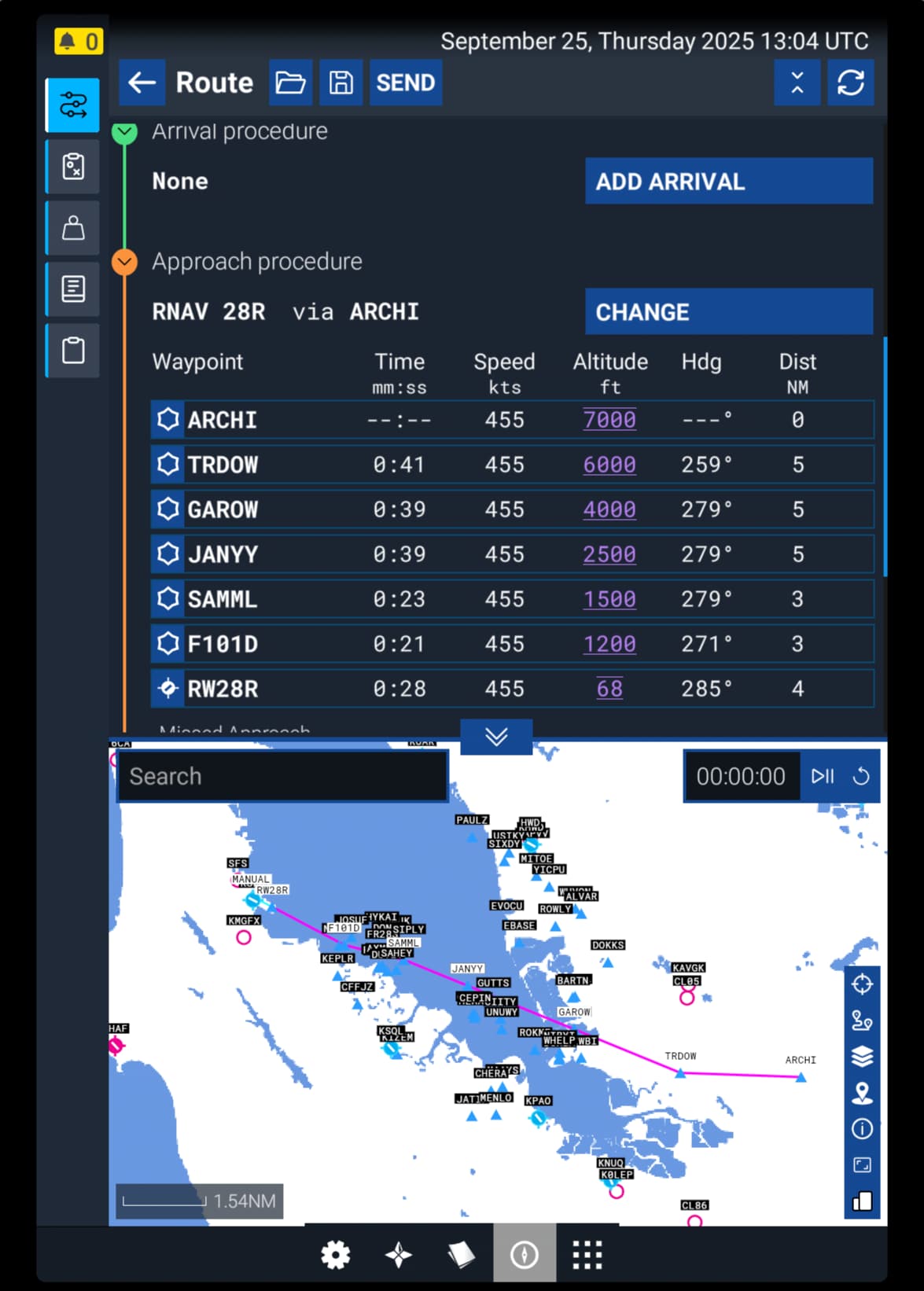
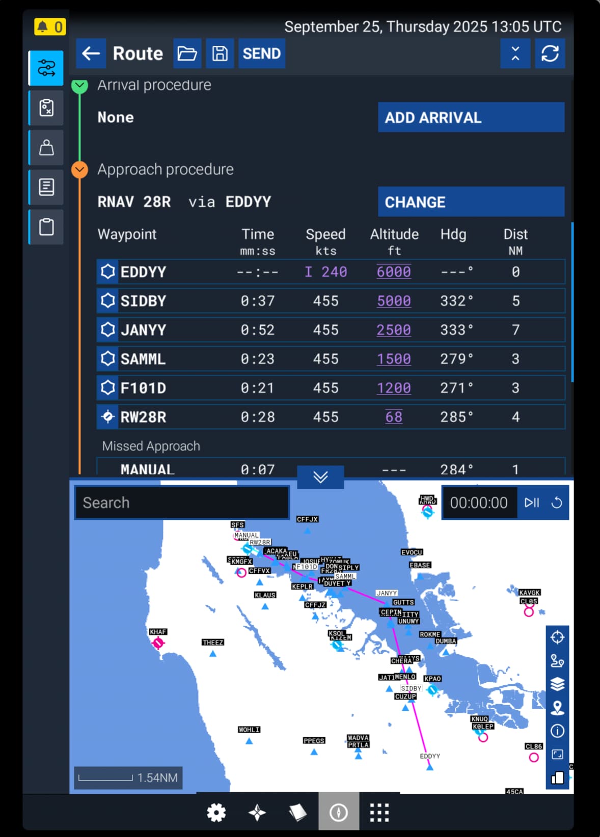
The FMS Bridge Visual Rwy 28R has been slightly updated and adopted by many/most U.S. (and probably Canadian) airlines. After IF JANYY, the current version replaces SAAML and F101D with RAACL, DYLEE, and SAPPP (followed by RW28R). In order to reduce unnecessary TCAS RAs, the revised final approach segment reduces the angle/lateral rate of convergence between an aircraft on this approach and one established on the parallel 28L localizer.
I have attempted to code this into 132-character ARINC 424 format, which I believe I have done fairly successfully. However, I have very limited experience with ARINC 424 and I’m using an out of date specification, so there may be errors.
I imagine the new waypoints (RAACL, DYLEE, and SAPPP) are not in the Navigraph database. I left latitude/longitude information out of the attached file, but I can add that information for the waypoints in question if needed.
While operators and navigation data providers use various FMC naming conventions, I left the current Navigraph FMS identifier for this approach intact (R28RF).
Please let me know if there are any other corrections necessary.
If this works out, I can also explore coding the Tipp Toe Visual for 28L and 28R, which many operators have available in their navigation databases (rather than having to manually build in the FMC or fly using only raw data).