Hello,
I initially reported this at PMDG support, but I was told this is a Navigraph issue.
Please take a look at the screenshot:
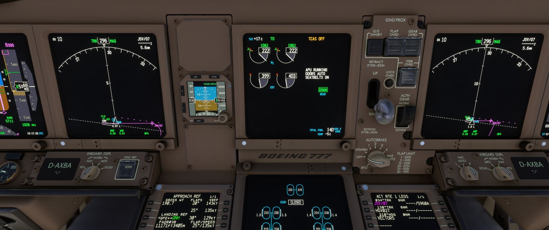
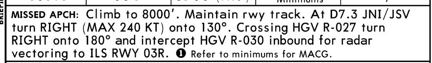
It shows the missed approach part of FAOR ILS W 03R. That screenshot was taken on the ground, because it shows the problem the clearest, but it looked the same during planning and approach. As you can see, the JSV/07 waypoint is anchored to radial 034° of the VOR and offset from the runway centerline. Based on the charts however, I would have expected it to be anchored to track 034° of the runway centerline.
I’m using AIRAC 2507, the addon is the PMDG 777-200LR.
Hi,
I´m unsure if this is not a scenery issue because the runway heading is 036° instead of 034°, as expected. However, we have 034° in our database, which is correct according to the AIP and our charts.
But when you sit on 03R, you see a heading of 036°, and that’s precisely the reason for the offset. I have tested this with the C172 and the G1000, too; the same effect. The runway heading (or the magnetic variation) is wrong in the stock scenery.
It seems that this has nothing to do with PMDG or the data—the data shows 034°, which is the runway heading, but when the runway heading is 2 degrees off, it can´t be fit.
Cheers,
Richard
Hi Richard,
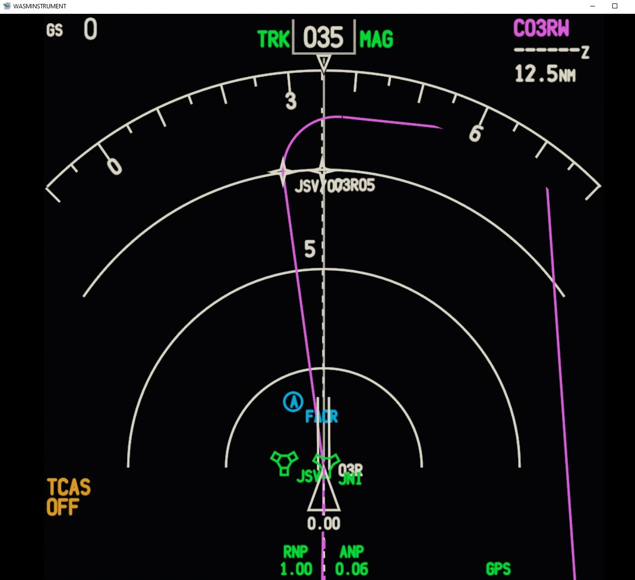
Thank you for the answer, but I don’t think you are correct. If the runway heading or magnetic variation was the problem, then the waypoint would be offset only by 2 degrees. This screenshot was taken on the threshold of 03L:
You can see, that the track to the waypoint is 026 (HDG bug), which is way more. I also drew the 034 radial with the FIX page from JSV and you can see, that is matches up precisely. Therefore, I believe the problem is, that JSV/07 is anchored to the VOR instead of the runway centerline.
Hi,
Thanks, looks right, yes …
But I have checked the database, and here I can´t see any navdata issue:
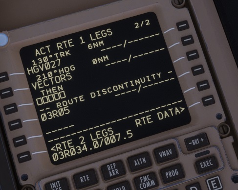
You see clearly that the missed approach starts at RW03R with a FD (Fix to Distance) on course 034°/7.3 NM. That´s what we offer in the data, and that’s exactly what you see on the charts:
I have also added the reference to the RW03R (recommended navaid JSV 134.4/1.0NM).
I don´t see any mistake or error here. According to the data, the FD leg should be the JSV/07 (via RW03R/034°/7.3NM). When it´s not a scenery issue, it´s a PMDG issue. Do you have the forum link where PMDG told you that this is a navdata issue?
Thank you,
Richard
It was a support ticket. I will let them know of your answer. Thank you very much for checking!
You are welcome, when possible let us know the result 
Thank you
Richard
Looks like the FD leg WPT is constructed out of the VOR by the PMDG 777 instead of the RWY.
JSV 034/D7.3 instead of RWY03R 034/JSV D7.3
I created a manual Place bearing distance WPT with 034 deg and 7.5NM to approximate the DME distance. Magvar is not the big issue here, its the construction of the Leg.
Would put it back to PMDG in that case.
In the coding, I have highlighted the parts that belong togheter for the FD construction:
The lateral path should constructed from the RWY 03R until 7.3 DME from JSV.
F= RWY 03R, D=7.3 JSV.
As I wrote before, yes, it looks like they use the wrong reference (the recommended navaid instead of the waypoint). It seems to be a PMDG issue here.
Cheers,
Richard