Thanks for bringing this to our attention. We will investigate and likely forward this to our data provider who will have to verify and implement this change!
Unfortunately, no news as of yet. These are the issues we have noted, feel free to weigh in!
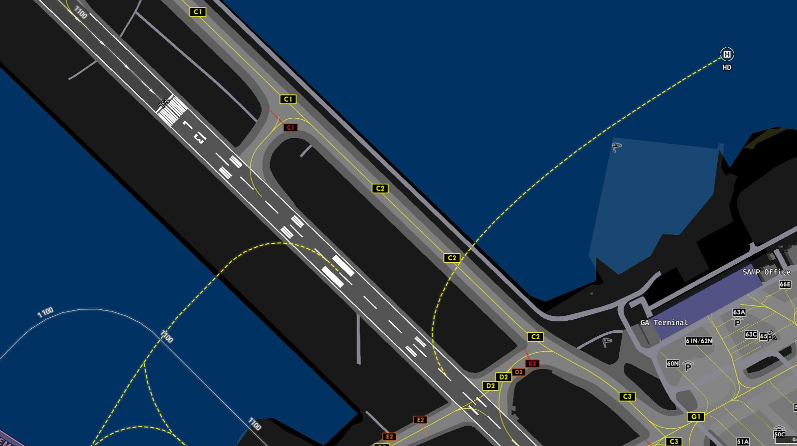
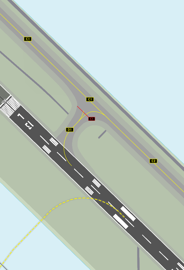
AMDB Map (the one in your screenshot) shows “C1” where it should say “D1” - named after the taxiway below it.
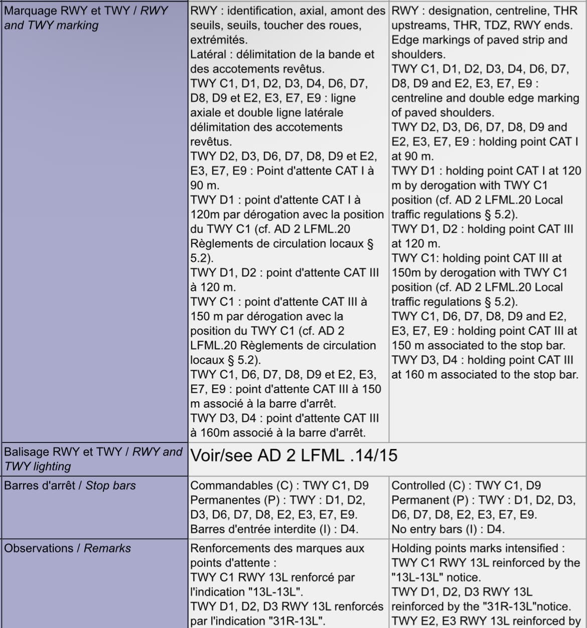
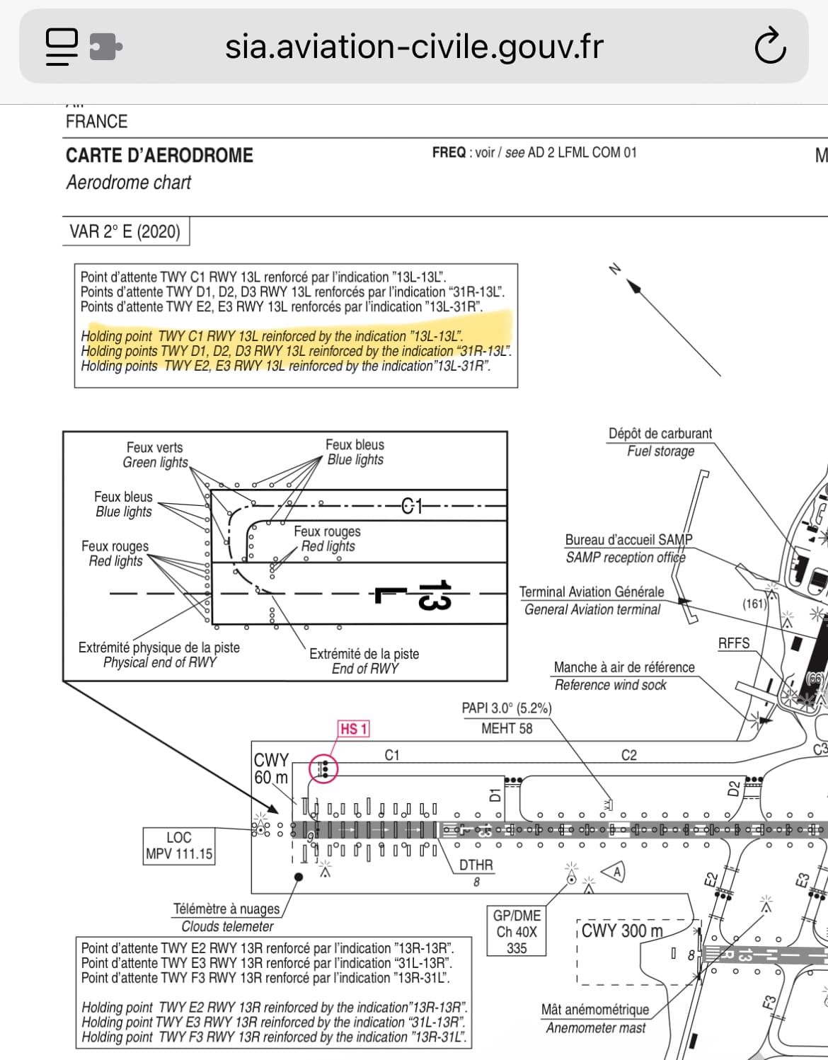
The French AIP does not include explicit names for these holding positions, so the holding positions are not named on the airport chart. The AIP charts only include names for the underlying taxiways. This means that separating the two becomes difficult compared to EGLL for example.
We have reached out to our data provider, and we shall keep you posted on the updates.
Thanks for the quick reply.
Although they’re not explicitly named on the charts, they’re defined in the AIP (see screenshot), with CAT I and CAT III holding point.
We are aware of both these documents. All references are “Holding point at taxiway x” - they do not have their own names. This is in contrast to other larger airports, such as EGLL, where some holding points even have names:
Regardless, finding these holding points and their exact locations is possible. Thus, the data should be updated to reflect both the position and correct naming.
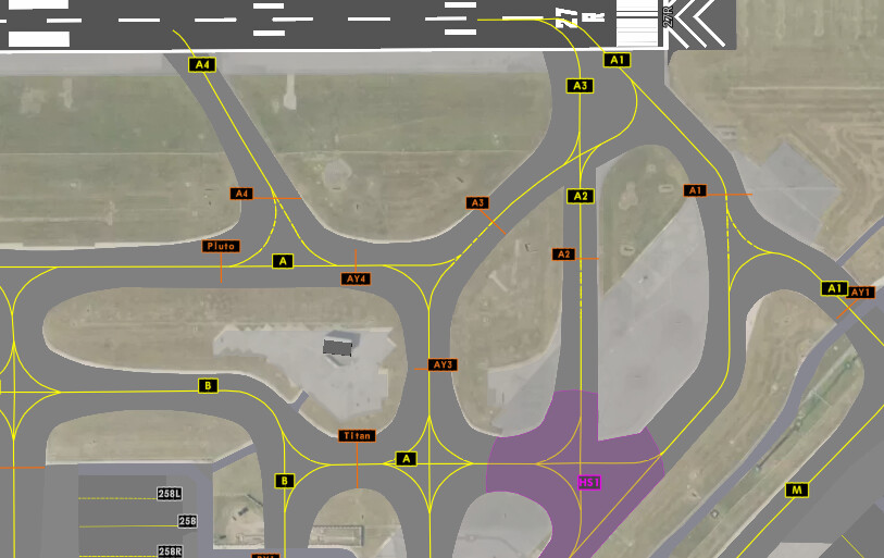
Hello again, sorry to bother, but it looks like D1 has completely disappeared from the World map (see picture, you can still see D2, although it correctly depicted on vatsim-radar). I’m using Navigraph windows version, latest update. If this a “me” thing please ignore (but not the initial issue).