Hi Navigraph experts,
It appears that in the desktop Navigraph Charts app the VFR maps show many (or all?) Aerodrome Traffic Zones (ATZ) as airspace X.
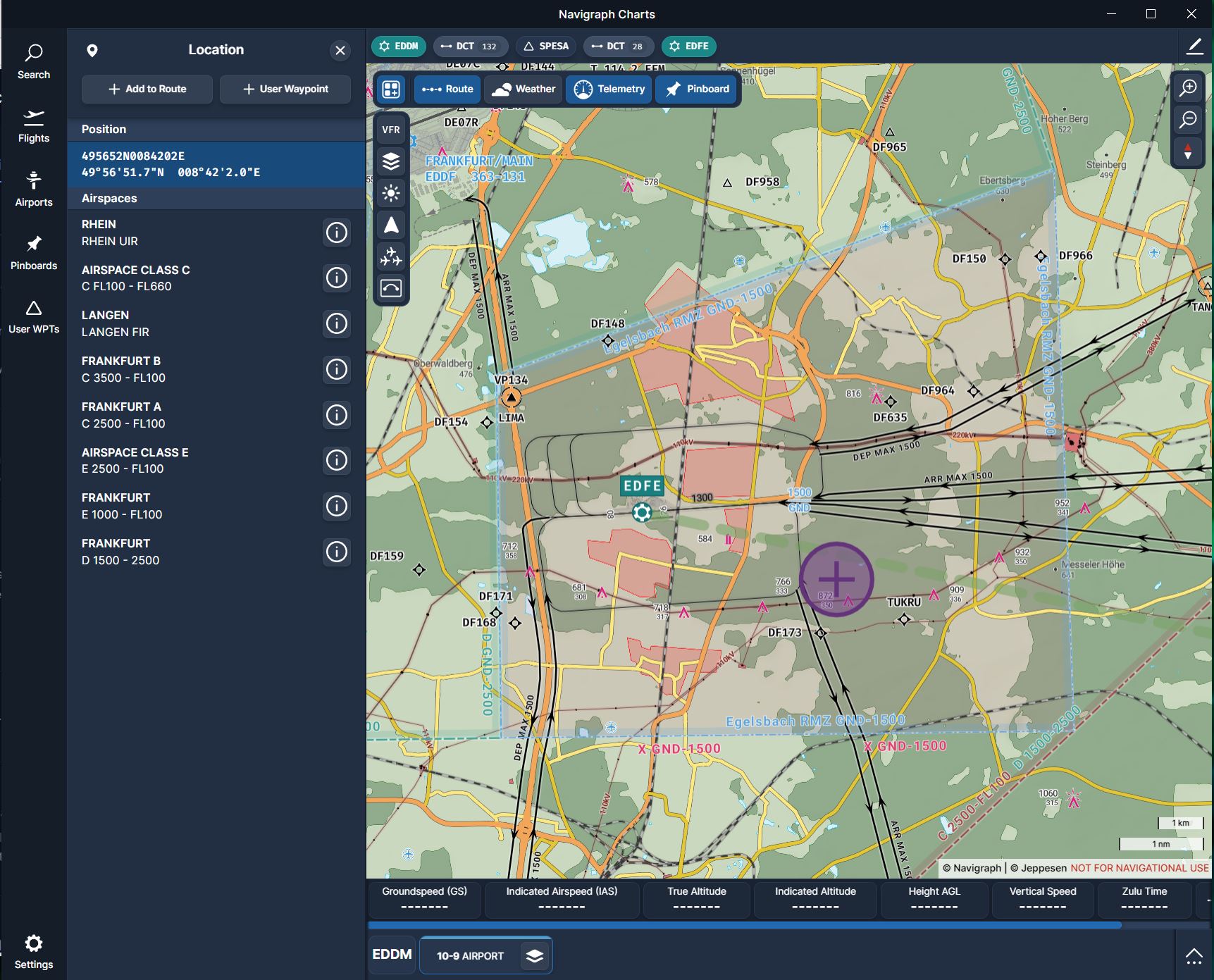
Additionally, when left-clicking into an ATZ the “Location” window opening on the left listing related airpsaces does not show any hint regarding the ATZ (or airspace X).
To me this is confusing, because e.g. AIP VFR charts show these as ATZ.
Examples are e.g.
- EDFE Frankfurt-Egelsbach
- EDLE Essen-Muelheim
Am I missing something or is this a bug?
Thank you and best regards
Holger
AIRAC: 2506 (but seen in older AIRACs as well)
The third ATZ in Germany is erroneously displayed as airspace X as well:
Not sure about other countries, but this seems to be a systematic problemin the charts.
AIRAC 2507
Example at EDFE:
As you can see the ATZ boundary is missing, instead an (unknown) airspace X is displayed.
The RMZ appears to be correct, but it is also not listed in the Locations airspaces list on the left of my screenshot.
The charts should show a ATZ/RMZ/TMZ from GND up to 1500 for the given coordinates.
Hope this helps to investiage the root cause.
Cheers
Holger
Hello! Thank you for the feedback!
We’ll look into this. “Class X” is what Jeppesen calls these types of airspaces, but we should be able to provide better information in the presentation.
As for the inconvenient fact that these types of airspace do not show up when searching the area using the geosearch (click) feature, that has a much more technical reason, which we currently can’t do much about - unfortunately.
I have forwarded this to the team to see what we can do in future iterations. Changing the label should be doable at the very least!
Hello,
I appreciate your effort making the charts better and better 
I fear it might be even more complicated:
Just looked into other countries, e.g. Italy:
- LIMW (Aosta) the ATZ is (probably) outlined blue and labeled as “AOSTA GND-8000”, but there no airspace label attached. I only guess this blue shape and label reflects the ATZ because the airspace G around Aosta is labeled red.
- LIPZ (Venezia) the ATZ is not shows at all, not even as “X”, only airspace D is shown and labeled red..
Let me know if I should attach screenshots to make my comment more clear.
Best regards
Holger